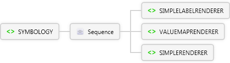
ArcPad Extension Preferences File Schema
SYMBOLOGY Element
See Also  Send comments on this topic.
ArcPad Extension Preferences File Schema : SYMBOLOGY Element

Glossary Item Box

Description

The parent element for symbology in an ArcPad map file (*.apm) or layer definition.

Diagram

SIMPLERENDERER Element VALUEMAPRENDERER Element SIMPLELABELRENDERER Element Sequence SYMBOLOGY Element

Overview

SYMBOLOGY
The parent element for symbology in an ArcPad map file (*.apm) or layer definition.
Sequence
SIMPLELABELRENDERER
Used for labeling features. A field is specified for labeling all features of a particular layer.
expression optional xs:string
field optional xs:string
language optional Restriction of xs:string
The script engine that interprets the expression.
refscale optional xs:string
rotationfield optional xs:string
rotationtype optional Restriction of xs:string
visible optional Restriction of xs:string
Sequence
TEXTSYMBOL
Symbol used to label point, line, and polygon layers.
VALUEMAPRENDERER
Used to render features according to the value in a specified field. Based on this field, a value map can be created to classify data.
lookupfield required
Name of field used to specify ranges for RANGE or exact values for EXACT.
refscale optional xs:string
rotationfield optional xs:string
rotationtype optional Restriction of xs:string
Sequence
EXACT 1..∞
label optional xs:string
value optional xs:string
The value associated with the text.
Sequence
COMPLEXLINESYMBOL
Used to symbolize line features. Provides additional symbology options beyond SIMPLELINESYMBOL.
COMPLEXPOLYGONSYMBOL
Used to symbolize polygon features. Provides additional symbology options beyond SIMPLEPOLYGONSYMBOL.
GROUPSYMBOL
Used to symbolize features with multiple symbols acting as a single symbol (e.g., a freeway line symbol consists of a group of 3 line symbols).
RASTERFILLSYMBOL
Symbolizes polygon features using the specified image as a fill symbol.
RASTERMARKERSYMBOL
Symbolizes point features using the specified raster image.
SIMPLELINESYMBOL
Used to symbolize line features.
SIMPLEMARKERSYMBOL
Used to symbolize point features using one of the predefined symbol types: circle, square, cross, triangle, star, X, or diamond.
SIMPLEPOLYGONSYMBOL
Used to symbolize polygon features.
TRUETYPEMARKERSYMBOL
Used to symbolize point features using TrueType symbols.
label optional xs:string
Sequence
COMPLEXLINESYMBOL
Used to symbolize line features. Provides additional symbology options beyond SIMPLELINESYMBOL.
COMPLEXPOLYGONSYMBOL
Used to symbolize polygon features. Provides additional symbology options beyond SIMPLEPOLYGONSYMBOL.
GROUPSYMBOL
Used to symbolize features with multiple symbols acting as a single symbol (e.g., a freeway line symbol consists of a group of 3 line symbols).
RASTERFILLSYMBOL
Symbolizes polygon features using the specified image as a fill symbol.
RASTERMARKERSYMBOL
Symbolizes point features using the specified raster image.
SIMPLELINESYMBOL
Used to symbolize line features.
SIMPLEMARKERSYMBOL
Used to symbolize point features using one of the predefined symbol types: circle, square, cross, triangle, star, X, or diamond.
SIMPLEPOLYGONSYMBOL
Used to symbolize polygon features.
TRUETYPEMARKERSYMBOL
Used to symbolize point features using TrueType symbols.
RANGE 1..∞
Used with VALUEMAPRENDERER for matching a range of values within a specified field in a shapefile's DBF table. When a match occurs, the symbol is drawn as specified for each range.
lower required xs:string
Lower value of range; can be a numeric, string, or date value.
upper required xs:string
Upper value of range; can be a numeric, string, or date value.
label optional xs:string
Sequence
COMPLEXLINESYMBOL
Used to symbolize line features. Provides additional symbology options beyond SIMPLELINESYMBOL.
COMPLEXPOLYGONSYMBOL
Used to symbolize polygon features. Provides additional symbology options beyond SIMPLEPOLYGONSYMBOL.
GROUPSYMBOL
Used to symbolize features with multiple symbols acting as a single symbol (e.g., a freeway line symbol consists of a group of 3 line symbols).
RASTERFILLSYMBOL
Symbolizes polygon features using the specified image as a fill symbol.
RASTERMARKERSYMBOL
Symbolizes point features using the specified raster image.
SIMPLELINESYMBOL
Used to symbolize line features.
SIMPLEMARKERSYMBOL
Used to symbolize point features using one of the predefined symbol types: circle, square, cross, triangle, star, X, or diamond.
SIMPLEPOLYGONSYMBOL
Used to symbolize polygon features.
TRUETYPEMARKERSYMBOL
Used to symbolize point features using TrueType symbols.
SIMPLERENDERER
Used to display features using one symbol.
refscale optional xs:string
rotationfield optional xs:string
rotationtype optional Restriction of xs:string
visible optional Restriction of xs:string
Sequence
COMPLEXLINESYMBOL
Used to symbolize line features. Provides additional symbology options beyond SIMPLELINESYMBOL.
COMPLEXPOLYGONSYMBOL
Used to symbolize polygon features. Provides additional symbology options beyond SIMPLEPOLYGONSYMBOL.
GROUPSYMBOL
Used to symbolize features with multiple symbols acting as a single symbol (e.g., a freeway line symbol consists of a group of 3 line symbols).
RASTERFILLSYMBOL
Symbolizes polygon features using the specified image as a fill symbol.
RASTERMARKERSYMBOL
Symbolizes point features using the specified raster image.
SIMPLELINESYMBOL
Used to symbolize line features.
SIMPLEMARKERSYMBOL
Used to symbolize point features using one of the predefined symbol types: circle, square, cross, triangle, star, X, or diamond.
SIMPLEPOLYGONSYMBOL
Used to symbolize polygon features.
TRUETYPEMARKERSYMBOL
Used to symbolize point features using TrueType symbols.

Remarks

Symbology specified for a layer in an ArcPad map file (*.apm) overrides the symbology specified for that layer in its layer file (*.apl).

Examples

Source

<xs:element name="SYMBOLOGY" xmlns:xs="http://www.w3.org/2001/XMLSchema">
  <xs:annotation>
    <xs:documentation>The parent element for symbology in an ArcPad map file (*.apm) or layer definition.</xs:documentation>
  </xs:annotation>
  <xs:complexType>
    <xs:sequence>
      <xs:element name="SIMPLELABELRENDERER">
        <xs:annotation>
          <xs:documentation>Used for labeling features. A field is specified for labeling all features of a particular layer.</xs:documentation>
        </xs:annotation>
        <xs:complexType>
          <xs:sequence>
            <xs:element ref="TEXTSYMBOL" />
          </xs:sequence>
          <xs:attribute ref="expression" />
          <xs:attribute ref="field">
            <xs:annotation>
              <xs:documentation>The field in the table that contains text for labeling features.</xs:documentation>
            </xs:annotation>
          </xs:attribute>
          <xs:attribute ref="language" />
          <xs:attribute ref="refscale" />
          <xs:attribute ref="rotationfield" use="optional" />
          <xs:attribute default="" ref="rotationtype" />
          <xs:attribute ref="visible" />
        </xs:complexType>
      </xs:element>
      <xs:element name="VALUEMAPRENDERER">
        <xs:annotation>
          <xs:documentation>Used to render features according to the value in a specified field. Based on this field, a value map can be created to classify data.</xs:documentation>
        </xs:annotation>
        <xs:complexType>
          <xs:sequence>
            <xs:element name="EXACT" maxOccurs="unbounded">
              <xs:complexType>
                <xs:sequence>
                  <xs:element ref="COMPLEXLINESYMBOL" />
                  <xs:element ref="COMPLEXPOLYGONSYMBOL" />
                  <xs:element ref="GROUPSYMBOL" />
                  <xs:element ref="RASTERFILLSYMBOL" />
                  <xs:element ref="RASTERMARKERSYMBOL" />
                  <xs:element ref="SIMPLELINESYMBOL" />
                  <xs:element ref="SIMPLEMARKERSYMBOL" />
                  <xs:element ref="SIMPLEPOLYGONSYMBOL" />
                  <xs:element ref="TRUETYPEMARKERSYMBOL" />
                </xs:sequence>
                <xs:attribute ref="label">
                  <xs:annotation>
                    <xs:documentation>Label for legend.</xs:documentation>
                  </xs:annotation>
                </xs:attribute>
                <xs:attribute ref="value">
                  <xs:annotation>
                    <xs:documentation>Values used for matching records in a selected field. Can be a numeric, string, or date value.</xs:documentation>
                  </xs:annotation>
                </xs:attribute>
              </xs:complexType>
            </xs:element>
            <xs:element name="OTHER">
              <xs:complexType>
                <xs:sequence>
                  <xs:element ref="COMPLEXLINESYMBOL" />
                  <xs:element ref="COMPLEXPOLYGONSYMBOL" />
                  <xs:element ref="GROUPSYMBOL" />
                  <xs:element ref="RASTERFILLSYMBOL" />
                  <xs:element ref="RASTERMARKERSYMBOL" />
                  <xs:element ref="SIMPLELINESYMBOL" />
                  <xs:element ref="SIMPLEMARKERSYMBOL" />
                  <xs:element ref="SIMPLEPOLYGONSYMBOL" />
                  <xs:element ref="TRUETYPEMARKERSYMBOL" />
                </xs:sequence>
                <xs:attribute ref="label">
                  <xs:annotation>
                    <xs:documentation>Label for legend.</xs:documentation>
                  </xs:annotation>
                </xs:attribute>
              </xs:complexType>
            </xs:element>
            <xs:element name="RANGE" maxOccurs="unbounded">
              <xs:annotation>
                <xs:documentation>Used with VALUEMAPRENDERER for matching a range of values within a specified field in a shapefile's DBF table. When a match occurs, the symbol is drawn as specified for each range.
                  </xs:documentation>
              </xs:annotation>
              <xs:complexType>
                <xs:sequence>
                  <xs:element ref="COMPLEXLINESYMBOL" />
                  <xs:element ref="COMPLEXPOLYGONSYMBOL" />
                  <xs:element ref="GROUPSYMBOL" />
                  <xs:element ref="RASTERFILLSYMBOL" />
                  <xs:element ref="RASTERMARKERSYMBOL" />
                  <xs:element ref="SIMPLELINESYMBOL" />
                  <xs:element ref="SIMPLEMARKERSYMBOL" />
                  <xs:element ref="SIMPLEPOLYGONSYMBOL" />
                  <xs:element ref="TRUETYPEMARKERSYMBOL" />
                </xs:sequence>
                <xs:attribute use="required" name="lower" type="xs:string">
                  <xs:annotation>
                    <xs:documentation>Lower value of range; can be a numeric, string, or date value.</xs:documentation>
                  </xs:annotation>
                </xs:attribute>
                <xs:attribute use="required" name="upper" type="xs:string">
                  <xs:annotation>
                    <xs:documentation>Upper value of range; can be a numeric, string, or date value.</xs:documentation>
                  </xs:annotation>
                </xs:attribute>
                <xs:attribute ref="label" />
              </xs:complexType>
            </xs:element>
          </xs:sequence>
          <xs:attribute name="lookupfield" use="required">
            <xs:annotation>
              <xs:documentation>Name of field used to specify ranges for RANGE or exact values for EXACT.</xs:documentation>
            </xs:annotation>
          </xs:attribute>
          <xs:attribute ref="refscale">
            <xs:annotation>
              <xs:documentation>Reference scale to display the TRUETYPEMARKERSYMBOL or SIMPLEMARKERSYMBOL at the specified fontsize using a relative scale such as 1:24000. TRUETYPEMARKERSYMBOLs and SIMPLEMARKERSYMBOLs are scaled relative to the refscale as the map is zoomed in or out.</xs:documentation>
            </xs:annotation>
          </xs:attribute>
          <xs:attribute ref="rotationfield">
            <xs:annotation>
              <xs:documentation>The field in the table that contains the angle of rotation for a TRUETYPEMARKERSYMBOL.</xs:documentation>
            </xs:annotation>
          </xs:attribute>
          <xs:attribute ref="rotationtype">
            <xs:annotation>
              <xs:documentation>Three methods of calculating angles are available: 1)"arithmetic", An angle of 0 is east, and angles are calculated counterclockwise from east. 2)"counterclockwise", An angle of 0 is north, and angles are calculated counterclockwise from north. 3)"geographic", An angle of 0 is north, and angles are calculated clockwise from north.</xs:documentation>
            </xs:annotation>
          </xs:attribute>
        </xs:complexType>
      </xs:element>
      <xs:element name="SIMPLERENDERER">
        <xs:complexType>
          <xs:sequence>
            <xs:element ref="COMPLEXLINESYMBOL" />
            <xs:element ref="COMPLEXPOLYGONSYMBOL" />
            <xs:element ref="GROUPSYMBOL" />
            <xs:element ref="RASTERFILLSYMBOL" />
            <xs:element ref="RASTERMARKERSYMBOL" />
            <xs:element ref="SIMPLELINESYMBOL" />
            <xs:element ref="SIMPLEMARKERSYMBOL" />
            <xs:element ref="SIMPLEPOLYGONSYMBOL" />
            <xs:element ref="TRUETYPEMARKERSYMBOL" />
          </xs:sequence>
          <xs:attribute ref="refscale" />
          <xs:attribute ref="rotationfield" />
          <xs:attribute default="" ref="rotationtype" />
          <xs:attribute ref="visible" />
        </xs:complexType>
      </xs:element>
    </xs:sequence>
  </xs:complexType>
</xs:element>

See Also

© 2012 All Rights Reserved.